Ogmius exchange
Climate, Floods and Public Policy:
What did we learn from the September 2013 Colorado floods?
by Nolan Doesken
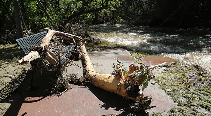
There’s nothing like heavy rain and flooding to stir up questions, especially when those floods go through urbanized areas and regions of gas and oil extraction. The rains of mid-September in Colorado, by coincidence, maximized directly over the city of Boulder, but affected nearly all the major population centers and many of the rivers of the Colorado Front Range. In a matter of a few days, Boulder went from being on track for another dry year to setting the record for all-time wettest water year (Oct-Sep) with 33.35”, the wettest month on record with 18.17”, and nearly doubled the old record for greatest rain in one day with 9.08” for the 24 hours ending at 5 PM September 12. Just south of Colorado Springs, an electronic rain gauge detected nearly 12” of rain in 24 hours which, if confirmed, sets a new statewide one-day rainfall record surpassing a record set back during the great floods of June 1965.
Media stories described this as a 1,000-year storm. But some in Boulder called it only a 25 or 50-year flood on Boulder Creek. Both claims were technically correct -- yet residential neighborhoods not normally considered in “flood plains” experienced extreme flooding. The terminology of “xx-year” storms always resonates with the media and the public but was only intended as a guide for planners, policy makers and engineers. Unintentionally, as useful as it may seem to be, it breeds exaggeration and misunderstanding. Regardless of nomenclature, it soon was apparent that if it rains hard enough, long enough, that any location can be a flood plain – at least for a time.
Extreme events always stir up policy questions. Are our flood plain definitions and requirements too stringent or too lax? Are we overdesigning (and overspending) or underdesigning (and underspending) on dams and spillways and storm water collection and conveyance? Should property owners be allowed to rebuild in the most vulnerable canyons and flood plains? Should rivers be returned to their original channels and land owners returned to their original properties, or should we let nature establish and claim new territories? These are policy questions, not climate questions. But climate data are useful in addressing them.
Unlike so many major floods from Colorado’s past, this recent event was remarkably well documented. With the help of hundreds of well-positioned automated rain gauges and well over 1,000 volunteer manual rainfall reports, the rains that caused this flood are known. Documenting streamflow has been tougher since several rivers washed out historic stream gauges and carved new channels. Yet, with the help of many observations of flow rates and high water marks and countless photographs, quality estimates of flood flows will be determined. We can put firm numbers on what hit us, and we can take stock of how much or how little we were impacted. That information does not dictate policy, but it should at least inform policy and we should take advantage of it. And while we still speculate as to whether floods like this will become more common as climate change provides a warmer environment for future storms, we have been keenly reminded that in the face of current policies, some of us remain vulnerable to the impacts from heavy rains and floods. We can also feel good, though, as no major dams or emergency spillways failed or came close to failure.
 Nolan Doesken Nolan Doesken
State Climatologist Colorado State University
nolan@atmos.colostate.edu
|